Visitor Insights
Visiting Poverty Point Earthworks
Poverty Point State Historic Site provides visitors with an immersive journey into North America's ancient past. The site features a visitor center museum, a 2.6-mile driving tour loop, and elevated wooden boardwalks leading to the summit of Mound A.
Highlights
- Ascend Mound A (The Bird Mound) for panoramic views of the ancient earthwork complex.
- Explore museum artifact displays including jasper owl pendants and clay cookstones.
- Take a guided electric tram tour through the concentric C-shaped earthen ridges.
Things to Know
- Summer temperatures can be hot and humid, making early morning visits ideal.
- Walking trails cross open terrain, so sun protection and comfortable footwear are recommended.
Location
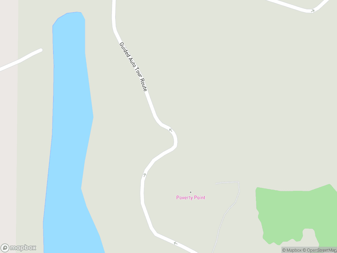
6859 La. Hwy. 577, Pioneer, LA 71266
Hours: Open daily 9:00 AM – 5:00 PM; closed Thanksgiving, Christmas, and New Year's Day
Getting There: Located off LA Hwy 577 in West Carroll Parish, 15 miles north of Interstate 20 via Exit 153 at Delhi.
Get DirectionsTips for Your Visit
Visitor Center Orientation
Begin at the visitor center to watch the introductory documentary film and view key artifacts before exploring the earthworks.
Mound A Boardwalk
Use the elevated wooden boardwalk to reach the top of Mound A safely without disturbing the fragile ancient soil layers.
About
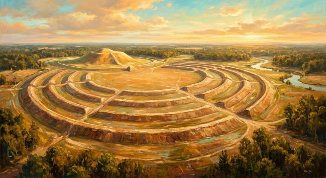
Poverty Point Earthworks is an extraordinary prehistoric indigenous ceremonial complex constructed between 1700 BCE and 1100 BCE by Late Archaic hunter-fisher-gatherers in northeastern Louisiana. Spanning nearly 910 acres on Macon Ridge, the site features six concentric earthen ridges, a 37-acre central plaza, and six massive earthen mounds engineered without draft animals or metal tools.
Designated a UNESCO World Heritage Site in 2014, Poverty Point served as a vast ceremonial gathering place and long-distance trade hub connecting cultures across eastern North America. Its builders moved roughly two million cubic yards of earth by hand, leaving behind a monumental cosmogram that stands as one of the world's most impressive early engineering achievements.
Gallery
Symbolic Elements
The temple's exterior features intricate carvings, each rich with spiritual meaning:

Semi-Octagonal Ridges
Concentric earthen C-shaped ridges configured into a cosmic perimeter facing the eastern sunrise.

Mound A Raptor Effigy
A 72-foot T-shaped mound representing a soaring raptor or sky spirit in Southeastern indigenous cosmology.

Mound C Stratigraphy
Sixteen distinct layers of alternating colored clays symbolizing cosmic balance and ceremonial renewal.

Carved Jasper Owls
Hand-carved red jasper owl pendants serving as protective amulets linked to nocturnal ancestral guidance.
Plaza Solar Post Circles
Massive timber post rings erected in the central plaza functioning as astronomical horizon calendars.

Poverty Point Objects
Hand-molded fire-hardened clay cookstones crafted to radiate precise heat in earthen cooking hearths.

Macon Ridge Elevation
The natural terrace placement elevating sacred architecture above seasonal floodwaters of Bayou Maçon.
Interesting Facts
Poverty Point was constructed over 3,100 years ago, making it older than the Roman Colosseum by more than 1,500 years (Tier A).
Every cubic yard of soil was dug and moved entirely by hand using woven baskets holding about 50 pounds of earth (Tier B).
The 72-foot Mound A was erected in less than 90 days without any internal rain erosion layers (Tier B).
Builders imported tons of exotic stone from up to 1,000 miles away despite having no local stone sources (Tier A).
Inhabitants created hand-molded clay cookstones to bake food in earth ovens without cooking pottery (Tier A).
Subsurface surveys revealed 36 giant timber circles in the plaza used to track equinoxes and solstices (Tier B).
Poverty Point proved that non-agricultural hunter-gatherer societies could organize monumental architecture (Tier A).
Pendants hand-carved from red jasper into the shape of horned owls were worn as protective amulets (Tier B).
UNESCO designated Poverty Point as North America's 22nd World Heritage Site in June 2014 (Tier A).
Common Questions
What is Poverty Point?
Poverty Point is a monumental 3,100-year-old indigenous earthen complex and UNESCO World Heritage Site in northeastern Louisiana.
Who built Poverty Point?
It was built by Late Archaic indigenous hunter-fisher-gatherers between 1700 BCE and 1100 BCE.
Why is the site named Poverty Point?
The site took its name from a 19th-century cotton plantation that once occupied the land before its archaeological significance was known.
Can visitors walk on the ancient mounds?
Visitors can ascend Mound A via an elevated wooden boardwalk designed to protect the ancient earthwork from erosion.
Featured Stories
The Rapid Mobilization of Mound A
1350 BCE
Soil core analysis reveals that the massive 72-foot Mound A was constructed with astonishing speed in less than ninety days. Thousands of indigenous builders converged on the site, carrying over fifteen million cubic feet of earth in hand-woven baskets without interruption from rain erosion. This incredible collective effort demonstrates extraordinary social cohesion and ceremonial devotion among hunter-gatherer communities.
Source: Washington University Archaeological Research Team
A Continental Gathering Hub
1500 BCE
Despite having no local stone deposits, Poverty Point accumulated tons of exotic minerals transported from distant regions across North America. Native trade networks brought copper from Lake Superior, soapstone from the Appalachian Mountains, and galena from Missouri. These precious materials were transformed by skilled craftspeople into sacred ornaments, ritual tools, and ceremonial weights.
Source: Louisiana Office of State Parks
The Redefinition of Archaic Society
1956
When archaeologists James Ford and Clarence Webb published their aerial photograph analysis in 1956, they transformed global anthropology. Before their discovery, scholars believed monumental earthworks required agricultural settlements with domesticated crops. Poverty Point proved that complex hunter-fisher-gatherer societies possessed the engineering mastery and organization to create monumental sacred landscapes.
Source: American Museum of Natural History Anthropological Papers
Timeline
Initial Site Foundation
Indigenous groups begin clearing Macon Ridge and constructing initial earthworks.
component.timeline.groundbreakingConcentric Ridge Construction
Laborers build six semi-octagonal earthen ridges forming a vast ceremonial cosmogram.
MilestoneRapid Completion of Mound A
Workers construct the 72-foot raptor effigy mound in a continuous multi-month effort.
DedicationConstruction of Mound F
The final earthen mound is completed north of the ridge complex.
MilestoneSite Dispersal
Active ceremonial use wanes as regional trade networks and environmental conditions shift.
EventFirst Documented Excavations
Clarence B. Moore conducts early archaeological investigations and publishes artifact reports.
EventNational Historic Landmark Designation
The United States Department of the Interior designates Poverty Point a National Historic Landmark.
MilestoneState Historic Site Established
Louisiana acquires core acreage to create the state historic site for public preservation.
MilestoneNational Monument Authorization
United States Congress authorizes Poverty Point National Monument as an NPS affiliate unit.
MilestoneUNESCO World Heritage Inscription
Poverty Point becomes North America's 22nd UNESCO World Heritage Site.
DedicationHistory by Decade
1700 BCE — Foundation of Sacred Center
Indigenous builders cleared the natural terrace along Macon Ridge to establish a permanent sacred gathering center. Early construction began with conical earthworks including Mound B and initial clay leveling within the central plaza.
1500 BCE — Concentric Ridge Expansion
Thousands of workers assembled six concentric semi-octagonal earthen ridges divided by five radiating aisles. The complex expanded into a major trade center, receiving raw minerals from across eastern North America.
1350 BCE — Construction of Mound A
Community laborers erected Mound A in a single massive construction campaign lasting only a few months. Over 15 million cubic feet of soil were transported in baskets to shape the soaring bird effigy mound.
1200 BCE — Final Mound Additions
Builders completed Mound F north of the ridge system as site activity began to decline. Shifting trade routes and environmental factors eventually led to the peaceful dispersal of the population.
1956 — Discovery of Geometric Layout
Archaeologists James Ford and Clarence Webb analyzed post-WWII aerial photographs, discovering the unified geometric footprint of the ridges. Their research defined the Late Archaic Poverty Point culture for modern science.
2014 — World Heritage Recognition
UNESCO inscribed Poverty Point as a World Heritage Site during its 38th session in Doha. The international committee recognized the earthworks as an unprecedented masterpiece of human creative genius.
Architecture & Facilities
A monumental Late Archaic geometric earthwork complex integrating sacred geometry, natural topography, and solar alignments into a massive semi-octagonal footprint.
Building Materials
Loess Silt Soil
Fine wind-deposited silt quarried locally and carefully transported in woven cane baskets to build mound cores.
Dense Clay Capping
Impervious clay layers packed over interior silt fills to prevent water infiltration and structural erosion.
Fired Clay Cookstones
Hand-molded geometric clay objects baked in hearth fires to supply radiant cooking heat in stone-scarce terrain.
Indigenous Timber Posts
Massive wooden tree trunks planted deep in plaza soil to construct expansive calendar circles and enclosures.
Interior Features
Central Plaza
A leveled 37-acre amphitheater space designed for seasonal gatherings, ritual dances, and astronomical observations.
Concentric Earthen Ridges
Six nested C-shaped ridge sectors accommodating domestic hearths, artisan workshops, and ceremonial living quarters.
Mound A Summit Platform
An elevated 72-foot high earthwork summit providing a panoramic ritual platform overlooking the entire cosmogram.
Mound C Ritual Earth Layers
Sixteen deliberate stratigraphical layers of colored clays deposited inside the plaza for symbolic renewal ceremonies.
Temple Grounds
The 910-acre protected grounds feature interpretive walking trails, elevated boardwalks, a 2.6-mile driving loop, and preserved natural forest along Macon Ridge.
Additional Facilities
The site features a climate-controlled visitor center and museum displaying thousands of authentic artifacts, an audiovisual theater, shaded picnic areas, and accessible electric tram tours.
Religious Significance
Poverty Point represents one of North America's oldest and most sophisticated sacred landscapes, engineered by Late Archaic peoples as a physical model of their cosmos.
To serve as a regional ceremonial center, astronomical calendar, and sacred gathering site uniting distant indigenous communities.
Sacred Ordinances
Solar Observation Rites
Communal gatherings aligned with solstices and equinoxes tracked across plaza timber circles and mound alignments.
Ceremonial Earth Layering
Ritual deposition of distinctly colored clays during earthwork construction symbolizing spiritual balance and renewal.
Sacred Exchange Rites
Interregional trade rituals involving exotic stones, copper, and jasper owl amulets brought from across North America.
Cosmological Earthwork Geometry
The C-shaped semi-octagonal layout faces east toward the rising sun, symbolizing rebirth and cosmic order while framing the communal plaza.
Similar Temples
Sources & Research
Every fact on Temples.org is backed by verified Sources & Research. Each piece of information is rated by source tier and confidence level.
View All Sources (4)
| Field | Source | Tier | Retrieved |
|---|---|---|---|
| Visitor Insights & Facilities | National Park Service (opens in a new tab) | A | 2026-02-18 |
| Architecture & World Heritage Significance | UNESCO World Heritage Centre (opens in a new tab) | B | 2026-02-18 |
| Symbolism & Trade Networks | Society for American Archaeology (opens in a new tab) | B | 2026-02-18 |
| Quick Facts & Historic Designation | National Historic Landmarks Program (opens in a new tab) | A | 2026-02-18 |