Visitor Insights
Visiting Mesa Grande Cultural Park
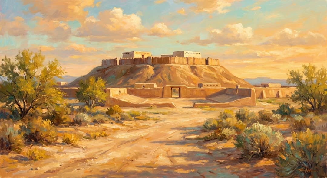
Mesa Grande Cultural Park offers an educational journey through an intact 900-year-old Hohokam platform mound and ceremonial landscape. Visitors walk a raised interpretive trail encircling the main mound while viewing original adobe cell foundations and a reconstructed rubber ballcourt.
Highlights
- 27-foot-tall elevated caliche platform mound
- Reconstructed Hohokam rubber ballcourt
- Visitor Center with ancient pottery and canal system scale models
- Interpretive trail with views of distant solstitial mountain alignments
Things to Know
- Open October through May only due to severe summer heat
- Weekend open hours with weekday group tours by reservation
Location
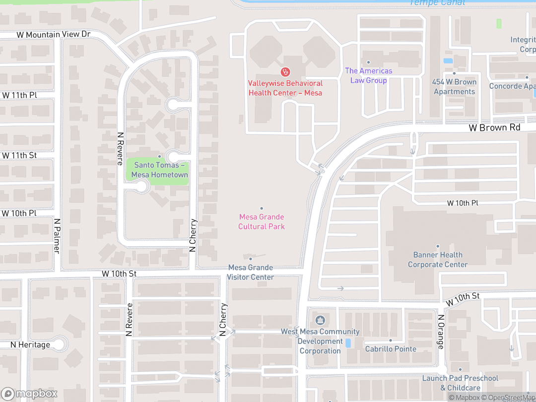
1000 N Date Street, Mesa, Arizona 85201, United States
Hours: Saturdays 10:00 AM - 4:00 PM, Sundays 12:00 PM - 4:00 PM (October–May only)
Getting There: Located two blocks east of Country Club Drive on 10th Street in Mesa, accessible via US-60 or Loop 202.
Get DirectionsTips for Your Visit
Seasonal Planning
Visit between November and March for mild weather and clear views of distant mountain solstitial sightlines.
Docent Tours
Take a docent-led walking tour to understand the intricate canal networks that sustained desert agriculture.
About
Mesa Grande Cultural Park, known natively as Sce:dagĭ Mu:val Va'aki ('Blue Fly's House'), protects a monumental Hohokam platform mound constructed between 1100 and 1450 AD. Standing 27 feet high and measuring 300 feet long, this sacred site served as the ceremonial, administrative, and spiritual center for a vast agricultural community in the Salt River Valley.
Positioned near the primary headgates of Main Canal System One, the mound's ancient leaders governed water distribution across 27,000 acres of irrigated desert fields. Master builders engineered the structure using interlocking cells of caliche adobe filled with compacted soil, creating an elevated complex isolated from the surrounding village by a massive perimeter wall.
In 2024, the City of Mesa partnered with the Four Southern Tribes of Arizona to restore its ancestral O'odham name. Today, the six-acre archaeological park is preserved as a living sacred site, offering visitors an immersive encounter with ancient Indigenous engineering, archaeoastronomy, and desert culture.
Gallery
Symbolic Elements
The temple's exterior features intricate carvings, each rich with spiritual meaning:

The Raised Mound (Va'aki)
Serves as an elevated axis mundi bridging earthly life with sacred celestial realms.

Blue Fly (Sce:dagĭ Mu:val)
Symbolizes spiritual presence, transformation, and ancestral guardianship in O'odham tradition.

Solstitial Sightlines
Aligns structural corners with mountain horizons to track solar and planting cycles.

Canal Headworks
Represents the sacred conveyance of life-giving water across arid desert soils.

Earthen Ballcourt
Embodies cosmic duality and communal realignment through ritual athletic competition.

Caliche Palisade Wall
Delineates the sacred elevated precinct from the surrounding secular village.

Cellular Adobe Core
Reflects structured engineering harmony through interlocking earth-filled structural boxes.

Ceremonial Public Plaza
Provides a central sacred gathering space for regional trade, feasts, and rituals.
Interesting Facts
Mesa Grande controlled irrigation for 27,000 acres of desert farmland using hand-dug canals. (Tier A)
It is one of only two preserved major Hohokam platform mounds in the Phoenix metropolitan area. (Tier A)
The mound was built using hollow adobe cells filled with compacted earth rather than solid dirt piles. (Tier B)
Ancient Hohokam rubber balls found nearby were traded over 1,000 miles from Mesoamerica. (Tier B)
In the 1970s, the ancient sacred site was privately owned by B-movie actress Acquanetta. (Tier C)
Mormon pioneers in the 1870s built Mesa's original canals by clearing ancient Hohokam channels. (Tier B)
Caliche building material acts as a natural concrete that cures harder when exposed to desert rain. (Tier B)
The park was renamed Sce:dagĭ Mu:val Va'aki in 2024 to restore its traditional O'odham identity. (Tier A)
Priests atop the mound tracked solstices by aligning corners with distant mountain peaks. (Tier B)
Common Questions
What does Sce:dagĭ Mu:val Va'aki mean?
It translates to 'Blue Fly's House' or 'Blue Fly's Place of Dwelling' in the traditional O'odham language.
How tall is the platform mound?
The platform mound stands 27 feet (8.2 meters) high and spans roughly 300 by 150 feet.
Is Mesa Grande open year-round?
No, the park operates from October through May and is closed during summer due to extreme heat.
Who built the platform mound?
It was built by the Ancestral Sonoran Desert Peoples, known archaeologically as the Hohokam.
Can visitors walk on top of the mound?
No, visitors walk on a surrounding elevated trail to protect fragile archaeological structures.
Featured Stories
Engineering the Great Canal Grid
c. 1150 AD
Without draft animals or metal equipment, Hohokam engineers constructed over 500 miles of major irrigation canals across the Salt River Valley. By managing complex water flow dynamics, leaders at Mesa Grande sustained thriving desert agricultural fields that fed thousands of inhabitants for generations.
Source: Salt River Pima-Maricopa Tribal Heritage Archives
The B-Movie Actress Preservation Era
1970s–1980s
Before municipal protection, the ancient mound rested on private land owned by cult horror film star Acquanetta and her husband Jack Ross. Their refusal to sell to commercial developers preserved the 6-acre site until the City of Mesa acquired it for permanent public protection in 1988.
Source: Mesa Historical Society Records
Restoring the Ancestral Name
November 4, 2024
In a landmark ceremony attended by state leaders and Four Southern Tribes officials, Mesa Grande was formally renamed Sce:dagĭ Mu:val Va'aki. The restoration honored centuries of O'odham oral tradition and re-anchored Indigenous identity to the historic landscape.
Source: City of Mesa Official Proclamation
Timeline
Initial Construction
Hohokam builders lay the initial core of the platform mound near the Salt River canal headgates.
MilestoneClassic Period Expansion
Interlocking caliche adobe cells are filled with earth to raise the mound 27 feet high.
RenovationRegional Depopulation
Environmental stress and droughts lead to the gradual depopulation of Salt River Hohokam centers.
EventBoundary Survey Sketch
Commissioner John Russell Bartlett documents and sketches the Mesa Grande mound.
EventPioneer Canal Reuse
Settlers clear silt from ancient Hohokam canals to create Mesa's municipal water grid.
MilestonePreservation Campaign
Mesa citizens organize a Main Street parade advocating for the protection of Mesa Grande.
EventArchaeological Excavations
Arizona State University performs initial test excavations around the perimeter of the mound.
EventNational Register Listing
Mesa Grande is added to the National Register of Historic Places under private ownership.
MilestoneMunicipal Acquisition
The City of Mesa purchases the core 6-acre mound site for $1 million to ensure permanent preservation.
MilestoneVisitor Center Opening
The $1.6 million Mesa Grande Visitor Center opens to the public for seasonal visitation.
DedicationO'odham Name Restoration
The site is formally renamed Sce:dagĭ Mu:val Va'aki in partnership with local tribal nations.
MilestoneHistory by Decade
1100s — Foundation of the Va'aki
Hohokam civil engineers established the initial core of the platform mound near major canal headworks. The early structure served as an elevated ceremonial center and administrative post for local agricultural distribution.
1200s–1300s — Classic Period Peak
Workers expanded the mound into a 27-foot-tall complex using interlocking caliche adobe cells filled with earth. An elite residential compound and high perimeter wall isolated the sacred precinct from the surrounding 2,000-person village.
1400s — Environmental Stress & Abandonment
Severe droughts and sudden catastrophic flooding destabilized regional irrigation networks. Ancestral populations gradually dispersed from major Salt River centers, leaving the mound intact under desert soils.
1870s — Pioneer Settlement & Canal Reuse
Euro-American and Latter-day Saint settlers arrived in Mesa and identified the ancient canal depressions. By clearing centuries of silt, pioneers adapted the Hohokam canal alignments to build Mesa's modern municipal water system.
1970s–1980s — Historic Protection & Acquisition
Listed on the National Register of Historic Places in 1978, the site was protected from commercial redevelopment under private ownership. In 1988, the City of Mesa purchased the 6-acre parcel for $1 million to establish a permanent cultural park.
2010s–2020s — Public Opening & O'odham Restoration
The Mesa Grande Visitor Center opened in 2013 to provide seasonal public access and archaeological education. On November 4, 2024, the park was officially renamed Sce:dagĭ Mu:val Va'aki to honor ancestral O'odham heritage.
Architecture & Facilities
The architecture represents Classic Period Hohokam monumental earthwork construction, characterized by massive caliche adobe platform mounds, enclosed residential compounds, surrounding palisade walls, and adjacent earthen ballcourts.
Building Materials
Caliche Adobe
Dense calcium carbonate sub-desert deposits excavated and wetted to create concrete-like walls.
Compacted Earth Fill
Thousands of cubic yards of gravel, sand, and clay packed inside structural cells.
Saguaro Cactus Ribs
Structural ceiling joists utilized for flat-roofed superstructures atop the mound.
Mesquite & Cottonwood Timber
Heavy structural posts providing frame support for interior rooms and compound entrances.
Interior Features
Summit Ceremonial Chambers
Elevated plastered rooms used for high-status rituals and administrative gatherings.
Elite Residential Quarters
Private compound quarters reserved for civic-religious leaders atop the platform.
Internal Adobe Storage Cells
Rectangular structural retaining boxes filled solid with earth to elevate the mound height.
Terraced Access Ramps
Clay-paved steps providing controlled access from the public plaza up to the summit.
Temple Grounds
The six-acre grounds encompass an elevated perimeter trail, a reconstructed earthen ballcourt, and desert flora, all centered on the 27-foot mound.
Additional Facilities
Features a $1.6 million Visitor Center with artifact exhibit halls, educational classrooms, and docent-led tour staging areas.
Religious Significance
Sce:dagĭ Mu:val Va'aki served as the theological and cosmic center for ancestral Sonoran Desert agricultural communities.
To anchor civic governance, water stewardship, and celestial ceremony to an elevated physical axis mundi.
Sacred Ordinances
Solstitial Solar Observations
Priests tracked solar movements against distant mountain horizons to maintain the ceremonial planting calendar.
Water & Canal Blessing Rites
Ceremonies conducted near canal headworks to honor life-giving water and ensure crop fertility.
Ballcourt Ritual Competition
Sacred athletic games played with natural rubber balls to symbolize cosmic duality and community harmony.
The Va'aki as Axis Mundi
Elevated 27 feet above the desert floodplain, the platform mound established a physical link between human society, agricultural earth, and celestial powers.
O'odham Ancestral Continuity
Descendant Akimel O'odham and Tohono O'odham communities regard the site as a living ancestral sanctuary embodying enduring spiritual guardianship.
Sources & Research
Every fact on Temples.org is backed by verified Sources & Research. Each piece of information is rated by source tier and confidence level.