Visitor Insights
Visiting Willamette Falls Sacred Site
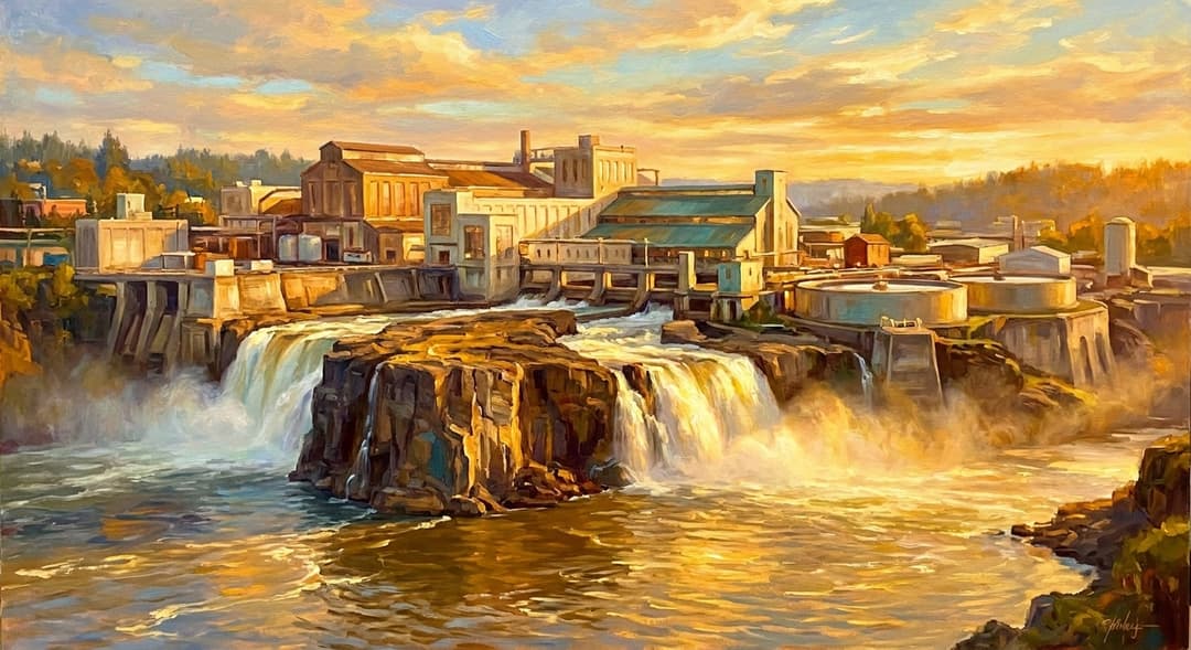
Visiting Willamette Falls offers a view of a thundering natural spectacle and a sacred Indigenous fishery currently undergoing tribal restoration. While shoreline access is currently closed for safety and construction, public overlooks along nearby bluffs provide expansive vistas.
Highlights
- Thundering view of the second-largest waterfall by volume in the United States
- Observation of traditional Pacific lamprey migration during late spring and early summer
- Elevated vistas across the 1,500-foot basalt horseshoe from Highway 99E
Things to Know
- Direct water-level access at tumwata village remains closed during environmental restoration
- Overlooks along public roads are exposed to weather, so dress in layers
Location
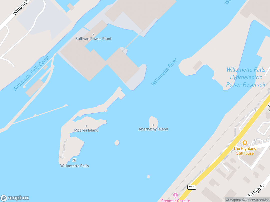
120 McLoughlin Blvd, Oregon City, OR 97045
Hours: Public viewing overlooks are open 24 hours a day, year-round.
Getting There: Located in Oregon City, 13 miles south of Portland off Interstate 205 and Highway 99E.
Get DirectionsTips for Your Visit
Bring Binoculars
Binoculars help you observe subtle details like traditional dip-net fishing and jumping fish.
Visit in Early Spring
Peak water volume occurs between February and April, producing a thundering curtain of spray.
About
Willamette Falls, known in Chinook Wawa as tumwata, is a sacred natural sanctuary and vital First Food harvesting site for Pacific Northwest Native nations. For thousands of years, Chinookan communities flourished along these basalt shores, using the rushing waters for spiritual cleansing, trade, and dip-net fishing.
Geologically sculpted by Ice Age Missoula Floods across Columbia River basalt, the 1,500-foot-wide horseshoe waterfall drops 40 to 42 feet and carries immense hydrologic power. In 2019, the Confederated Tribes of Grand Ronde reacquired 23 acres of their ancestral land at the falls, establishing tumwata village to restore the riparian ecology and re-establish Indigenous stewardship.
Gallery
Symbolic Elements
The temple's exterior features intricate carvings, each rich with spiritual meaning:

tumwata (Rushing Water)
The rushing water represents perpetual spiritual energy and the living breath of the Creator.
Pacific Lamprey (K'suyas asum)
This ancient jawless fish symbolizes tenacity and endurance by suction-climbing vertical wet basalt.

Salmon (Nsayka lili)
Salmon represent self-sacrificing relatives whose annual return sustains physical and spiritual life.

Coyote (T'allapus)
The transformer figure T'allapus created the falls in tradition to establish an abundant fishery for the people.

Basalt Scablands
Dark volcanic rocks hold the memory of ancestral footsteps and ground the physical sanctuary.

Traditional Fishing Scaffolds
Timber dip-net platforms reflect thousands of years of sustainable engineering and cultural continuity.

Camas Roots
A sacred root harvested along riverbanks, representing seasonal cycles and ancestral trade.
Interesting Facts
Willamette Falls is the second-largest waterfall by water volume in the United States after Niagara Falls. (Tier A)
The site is a critical sanctuary for Pacific lamprey, a jawless species over 450 million years old that climbs vertical basalt walls. (Tier A)
The name tumwata originates from Chinook Wawa, an inter-tribal trade language spoken across the Pacific Northwest. (Tier B)
Indigenous oral history attributes the creation of the waterfall to T'allapus (Coyote), who placed a giant basalt barrier in the river. (Tier B)
In 1889, the site generated the nation's first long-distance commercial direct-current electricity transmission to Portland. (Tier A)
Industrial mill construction walled off tribal and public physical access to the waterfall shoreline for over 150 years. (Tier B)
The Confederated Tribes of Grand Ronde purchased the 23-acre paper mill site in 2019 to establish tumwata village. (Tier A)
The surrounding area served as the official, legal land terminus for 19th-century pioneers on the Oregon Trail. (Tier B)
Cataclysmic Ice Age Missoula Floods sculpted the 1,500-foot-wide basalt horseshoe between 15,000 and 13,000 BC. (Tier A)
Common Questions
Why is Willamette Falls sacred to Indigenous tribes?
It is an ancestral gathering place and sacred fishery created by Coyote where First Foods like salmon and lamprey are harvested.
Can the public walk up to the edge of Willamette Falls?
Direct riverbank access is currently closed for safety during active tribal site restoration, but public overlooks offer clear views.
What does tumwata mean?
tumwata is the Chinook Wawa term for waterfall or rushing water.
Where is the best public viewing spot for the waterfall?
The Willamette Falls Scenic Viewpoint on Highway 99E in Oregon City provides an unobstructed view of the horseshoe crest.
Featured Stories
The Reclamation of tumwata village
August 2019
In August 2019, the Confederated Tribes of Grand Ronde purchased the 23-acre former Blue Heron Paper Mill site for $15 million. This historic land acquisition restored tribal ownership to their ancestral sanctuary after more than 150 years of industrial exclusion. The Tribe immediately launched demolition and remediation efforts to heal the land and establish tumwata village.
Source: Confederated Tribes of Grand Ronde
The Legend of T'allapus and the Falls
Time Immemorial
According to regional oral traditions, the legendary transformer Coyote created the dramatic horseshoe waterfall during a dispute with a giant meadowlark. By placing a giant stone across the river, Coyote formed a natural cascade that slowed migrating fish, allowing Indigenous communities to harvest First Foods efficiently. The site remains a sacred physical testament to Coyote's gifts.
Source: Chinookan Oral Tradition
Ceremonial Lamprey Harvests on the Basalt
May 2018
For millennia, tribal fishers have braved thundering waters on hand-built timber scaffolds to dip-net Pacific lamprey from slippery basalt walls. In 2018, tribal leaders re-erected a formal ceremonial fishing platform directly at the base of the falls. This annual spring harvest honors ancestral treaty rights and maintains unbroken spiritual ties to sacred First Foods.
Source: Grand Ronde Cultural Resources Department
Timeline
Cataclysmic Missoula Floods
Glacial outburst floods carve the 1,500-foot basalt horseshoe across the Willamette River.
MilestoneHudson's Bay Company Settlement
Dr. John McLoughlin establishes a commercial claim at the falls to harness timber water power.
EventIncorporation of Oregon City
Oregon City is founded as the first incorporated American city west of the Rocky Mountains.
MilestoneWillamette Valley Treaty
Indigenous nations are forcibly relocated from their ancestral falls to tribal reservations.
EventOpening of Willamette Falls Locks
A stepped canal system opens to allow riverboat navigation past the natural waterfall barrier.
MilestoneFirst Long-Distance Electrical Transmission
Direct-current electricity is generated at the falls and sent 14 miles downriver to light Portland.
MilestoneIndustrial Paper Mill Expansion
Paper mill facilities fully encircle the natural basalt shelf with heavy masonry.
EventBlue Heron Paper Mill Bankruptcy
The final operating paper mill closes, paving the way for ecological and tribal land restoration.
MilestoneCeremonial Scaffold Construction
Tribal fishers construct a dedicated ceremonial dip-net fishing platform at the base of the falls.
EventGrand Ronde Land Reacquisition
The Confederated Tribes of Grand Ronde purchase the 23-acre former mill site to restore their homeland.
MilestoneNaming of tumwata village
The reacquired site is formally designated tumwata village as toxic remediation and demolition advance.
MilestoneArchitecture & Facilities
A massive, horseshoe-shaped natural sanctuary carved into Columbia River flood basalt by Ice Age floods, framed by river currents and modern restoration structures.
Building Materials
Grande Ronde Basalt
Volcanic flood basalt extruded 15 million years ago forming the core ledge.
Columbia River Water
A continuous flow averaging over 30,000 cubic feet per second across the rocks.
Cedar Wood Scaffolds
Traditional timber dip-net platforms anchored into basalt crevices by Indigenous fishers.
Restoration Basalt and Steel
Native stone and weathered steel integrated into riverwalk designs.
Interior Features
Horseshoe Crest
The primary 1,500-foot curtain where river waters plunge over the volcanic shelf.
Basalt Scabland Pools
Carved rock channels where Pacific lamprey cling and migrate upstream.
Ceremonial Fishing Platforms
Elevated timber structures positioned over roaring waters for ceremonial harvest.
Restored Riparian Corridor
Ecological buffer zones featuring native flora and returned riverbank habitat.
Temple Grounds
The site spans 23 acres of reacquired riverfront at tumwata village along with surrounding basalt bluffs and viewing overlooks.
Additional Facilities
Public viewing platforms, interpretive panels at scenic viewpoints, and planned tribal heritage centers.
Religious Significance
To Pacific Northwest Indigenous nations, tumwata is a living sanctuary where natural forces and sacred First Foods embody divine reciprocity.
Serves as an ancestral gathering place for prayer, ceremonial First Food harvests, and inter-tribal diplomacy.
Sacred Ordinances
First Salmon Ceremony
Ritual songs, prayers, and the respectful return of fish bones to ensure eternal renewal.
Pacific Lamprey Harvest
Ceremonial gathering of sacred First Foods using traditional dip-nets on wet basalt walls.
Spiritual Cleansing
Purification rites using the mist and rushing waters of the roaring waterfall.
Coyote and the First Foods
Oral tradition records that T'allapus (Coyote) placed the basalt barrier here so migratory fish would gather in pools to feed the people.
Similar Temples
Sources & Research
Every fact on Temples.org is backed by verified Sources & Research. Each piece of information is rated by source tier and confidence level.
View All Sources (8)
| Field | Source | Tier | Retrieved |
|---|---|---|---|
| About & Historical Background | Confederated Tribes of Grand Ronde (opens in a new tab) | A | 2026-02-23 |
| About & Historical Background | Willamette Falls Trust (opens in a new tab) | B | 2026-02-23 |
| Architecture & Sacred Geography | U.S. Geological Survey (opens in a new tab) | A | 2026-02-23 |
| Architecture & Sacred Geography | Snøhetta (opens in a new tab) | B | 2026-02-23 |
| Religious & Cultural Significance | Oregon Department of Fish and Wildlife (opens in a new tab) | A | 2026-02-23 |
| Timeline & Restoration History | Oregon Historical Society (opens in a new tab) | B | 2026-02-23 |
| Visitor Insights & Viewing Overlooks | City of Oregon City (opens in a new tab) | A | 2026-02-23 |
| Visitor Insights & Viewing Overlooks | Clackamas County (opens in a new tab) | A | 2026-02-23 |